

County invites community input on Snoqualmie Valley flood‑resilient corridor planning process
Snoqualmie Valley, WA — The County invites community members to provide input on the Cross Valley Study during a public comment period running November 2–20, 2026.
Launched in December 2022, the Cross Valley Study explores ways to reduce traffic disruptions caused by flooding in the Snoqualmie Valley. The study focuses on identifying a reliable travel corridor that can remain open during floods, using one of the four existing roads and bridges that cross the Snoqualmie River.
In October 2024, the County completed the first phase of the feasibility study, which identified two routes for further evaluation. The current phase assesses those two corridors in more detail to determine which option best supports long‑term mobility, safety, environmental considerations, community values, cost-effectiveness, affordability, and reliability during floods.
To support this work, the County is launching a public survey, open November 2–20, to better understand which factors community members prioritize in making this decision. The survey is available at: KingCounty.gov/Roads/Cross-Valley-Study
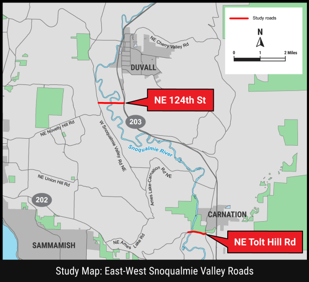
Residents are encouraged to visit the project website to learn more about the advantages and tradeoffs of each route and to review how all four original roads were evaluated.
Community feedback will inform the selection of a preferred corridor in this stage of the study.
For more information:
Visit the project website at KingCounty.gov/Roads/Cross-Valley-Study or contact Amy Bresslour, abresslour@kingcounty.gov

